Photo geolocation and coordinate metadata
Photo geolocation describes a coordinate and its context, including reference directions and uncertainty, separately from the place depicted or the location of a stored file.
A photograph's geolocation supplies a coordinate associated with the image. That can describe where the camera was, a subject location or a later assigned descriptive place, depending on the field and provenance.
It is unrelated to the filesystem path. Moving a picture from a laptop to a server changes storage, not the depicted scene's geographical location.
Magnitude and direction work together
Common Exif GPS coordinates store degree, minute and second magnitudes with separate latitude and longitude reference directions.
For an original illustrative coordinate:
Latitude:  51 degrees, 30 minutes, 0 seconds; N
Longitude:  0 degrees, 7 minutes, 12 seconds; W
Convert the magnitude to decimal degrees:
latitude  = 51 + 30/60 + 0/3600 = 51.5
longitude =  0 +  7/60 + 12/3600 = 0.12
North is positive latitude; west is negative longitude in this signed representation. The resulting pair is 51.5, −0.12.
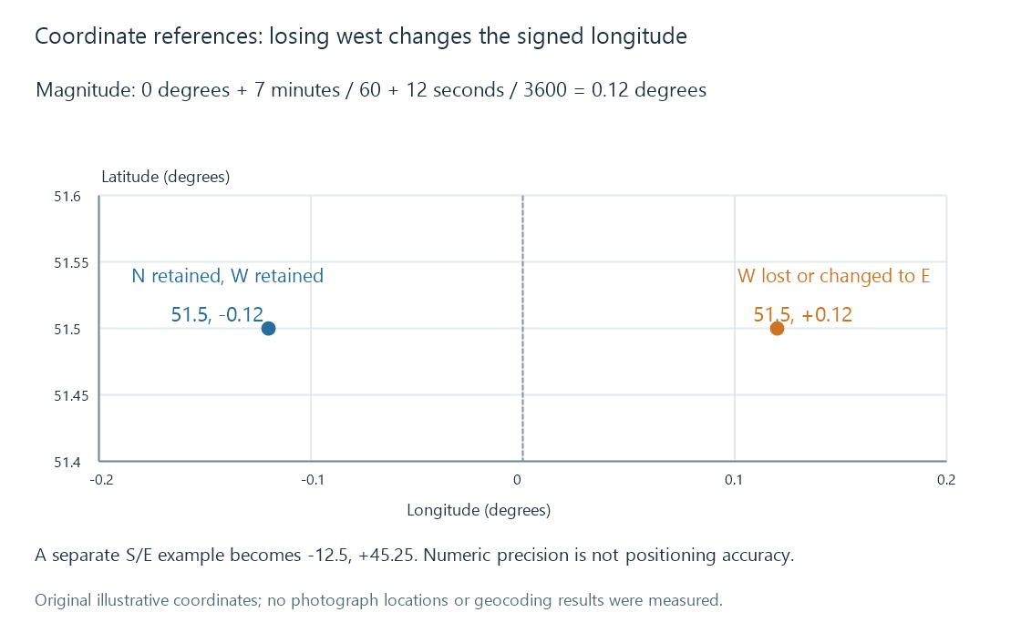
The diagram uses invented example records rather than measured photographs.
| Reference | Sign in the decimal pair |
|---|---|
| North latitude | Positive |
| South latitude | Negative |
| East longitude | Positive |
| West longitude | Negative |
Dropping the W reference turns −0.12 into +0.12 and places the point on the other side of the reference meridian. The coordinate's numeric magnitude alone was not enough.
Latitude, longitude and altitude are different axes
Latitude measures the north/south position; longitude supplies east/west position. Reversing them produces a different point, even when both values remain within allowed numeric ranges.
An altitude field has another reference. In a common Exif representation, a magnitude of 12 metres with the below-sea-level reference describes −12 metres under that convention. The number 12 alone does not establish which side of the reference surface is meant.
A complete position also needs its coordinate-system context. Exif provides relevant GPS fields, and representations can carry a map datum. A reader should not infer an arbitrary local grid or an altitude reference merely from three numbers.
Camera location and depicted location
A photograph taken across a river can show a landmark on the opposite bank. The camera coordinate and the landmark coordinate are different locations.
IPTC distinguishes location created from location shown. A human-readable place name can also be broader than a point: a region, city, harbour or venue.
Converting a point into a place label is a lookup or interpretation. It can choose a nearby feature or administrative area, while the original coordinate continues to carry its numeric meaning. A label such as Harbour does not establish an exact camera position.
A location field is still a descriptive claim. It can be captured automatically, added from a track log or entered later. Its provenance tells a catalogue how the claim was obtained; the pixels alone do not certify it.
Precision and accuracy are separate
Displaying six decimal places expresses small numeric increments. It does not prove that the positioning fix was accurate at that scale.
A fix can be uncertain, stale or deliberately approximate. Exif GPS metadata can include a horizontal-positioning error field. Retaining available uncertainty is more informative than extending the displayed decimal string.
The coordinate pair 0,0 is a real numerical position. It must not automatically stand for “location missing.” Absence and an actual zero coordinate need distinct representations.
A derived image can retain the location
A resized export can preserve the original location metadata even though the visible image becomes smaller. Another export can omit it. The picture's visual appearance does not reveal which metadata survived.
A catalogue may also retain a location in an external descriptive record while the exported file has none. Reading the exported resource and reading the original catalogue then answer different questions.
For an album grouped by place, the point or qualified place description provides evidence for membership. Capture dates provide another event dimension. The storage folder continues to locate the image bytes, while those descriptive fields explain where and when the photographed event belongs.
See Also
- Exif photo metadata
- IPTC Photo Metadata
- XMP metadata
- Photo capture dates and camera clocks
- Photo albums and picture membership